In and Around–what bounds Death Valley and vicinity?
We like exploring national parks and other scenic areas we can reach in a day’s drive from Tucson, Arizona. In years past, those trips might be for a run or bike ride. My running started to decline prematurely in my 40s. When I reached 50, I started using bicycles a lot. My wife can still run well, but is happy to ride bikes, too. Meanwhile, point and shoot cameras had become smarter, so I started carrying a camera circa 2005, to record what I saw. Over the years, Death Valley National Park has became our preferred destination when we have a few days free. We line up a room at Furnace Creek Ranch, drive there, then use that as our base of operations to explore the vicinity.
What is a reasonable scope for this project? One good context demarcation is the Lake Manly extended watershed. Death Valley is the bed of Lake Manly, the lowest point in a broad region of interconnected lakes when it’s wet enough that the lakes refill. That’s happened many times, with the earliest version of a lake in the valley occurring 3.35 million years ago as glacial climate emerged in North America. Here’s the most recent appearance of that lake system, which has largely dried up since the end of the Pleistocene epoch, 11,700 years ago. It will refill again when climate becomes wetter.
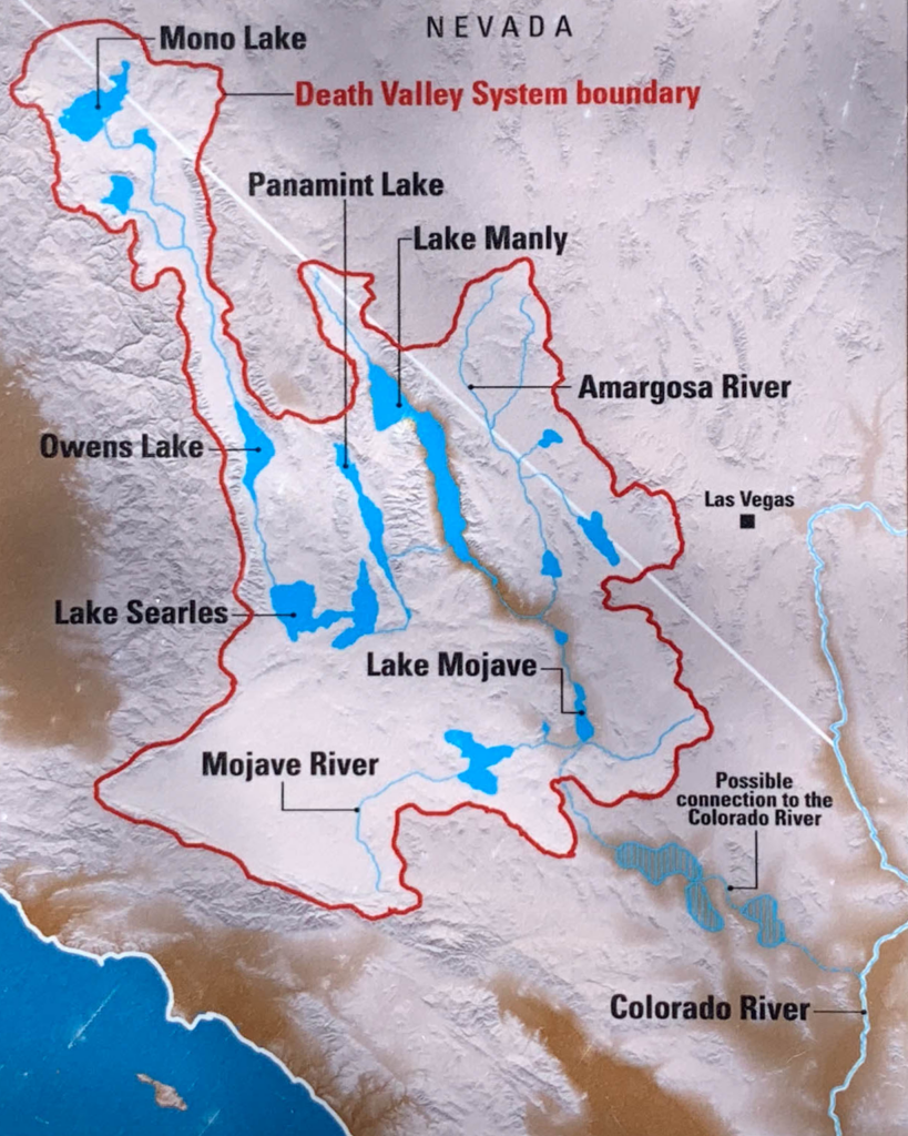
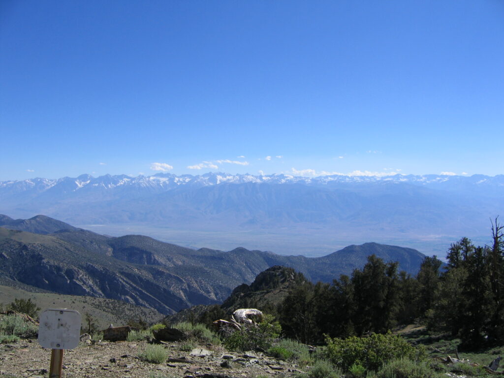
We’ve explored a lot of this area and taken thousands of photos. The west boundary of the watershed is the crest of the Sierra Nevada Mountains. I’m adding in the west slope of the Sierras as well. That’s a remarkably scenic region that includes the world’s largest trees, the giant sequoias. When my wife and I participated in the Death Ride from 2005-2009, I hauled our bikes to and from the ride and picked up my wife at the Reno NV airport since her work schedule limited her free time. The most direct route is up the Owens River Valley and through Mono Basin. I tended to take longer routes and side trips to the other side of Sierras.
Major Basins and Mountain Ranges, east to west of Death Valley.
The region of interest centered on Death Valley (DV), “in and around”, is part of the Basin and Range Province of western North America, except for the west slope of the Sierra Nevada Mountains. It’s characterized by north-south aligned mountain ranges alternating with basins (valleys). It extends from the Columbia Plateau in Oregon and Idaho well down into Mexico. In and Around DV is on the west side of the province, about midway. It includes the lowest and highest points fully within the province, Badwater Basin in Death Valley (-282 feet) and White Mountain Peak (14,252 feet) in the Inyo-White Mountains.
The Spring Mountains, west of Las Vegas, are the eastern boundary of In and Around. Their eastern slope drains into the Colorado River, the west into Death Valley (sometimes).
Pahrump Valley is to the west. In the Pleistocene watershed map at the top of the page, it’s shown as a lake due west of Las Vegas that drained into the Amargosa Valley. The Nopah Range is the largest of several small mountain ranges to the west.
The Amargosa Valley is next. It’s drained by the Amargosa River, the biggest current source of water for Death Valley. It flows south (mostly underground) then swings west and north.
The Amargosa Range runs 110 miles along most of the eastern side of Death Valley. From north to south, it consists of the Grapevine Mountains, the Funeral Mountains, and Black Mountains. Highest point is Grapevine Peak (8738 feet).
Death Valley itself is 140 miles long. It varies in width from 5 to 15 miles.
The Panamint Range runs north-south for about 100 miles, forming the western wall of Death Valley. From the Telescope Peak (11, 043 feet), one can stand facing east and look down into Badwater Basin. Turning around, you can see Mt. Whitney in the Sierras. So the lowest and highest point in the contiguous U.S. are visible from there. We’ve been there twice, unfortunately before I started carrying a camera. There are bristlecones near the top.
West of the Panamints are two valleys. Saline Valley is north of Panamint Valley.
The Inyo and White Mountains are actually a single continuous uplift west of Saline and Panamint Valleys. They are 110 miles long, Inyos south and Whites north. White Mountain Peak is the highest peak in the entire Basin and Range Province fully inside. The oldest known living tree, Methuselah is at an undisclosed location in the White Mountains.
West of those mountains are the Owens Valley and Mono Basin. The city of Los Angeles has diverted most of the water flowing from the Eastern Sierras into those valleys.
The western mountain range is the Sierra Nevada, a massive uplifted block that is still rising. It’s 400 miles long and 50-80 miles wide. The Range of Light is still growing at the rate of 1-2 millimeters per year.
The Heart of the Mojave Desert, south of Death Valley.
South of the ridges and valleys I’ve just listed is the core of the Mojave Desert. It is the driest, hottest, and smallest of the well known North American deserts. The others are the Chihuahuan, Sonoran, and Great Basin Deserts. Death Valley is part of that desert, although it’s an anomaly since most of the Mojave is considered “high desert” at 2,000-4,000 feet elevation. Its dryness is the rain shadow effect of Sierra Nevada to the northwest and the Transverse Ranges to the southwest. It includes areas to the east of the extended Death Valley watershed that nominally drains into the Colorado River